Routes to History: The Mail Carrier Who Accidentally Built America's First Geographic Encyclopedia
The Man Who Walked America Into Focus
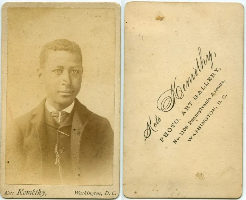
In 1923, when automobiles were still luxuries and most of rural America existed in the gaps between official maps, Chester Hartwell laced up his boots for what would become the most consequential mail route in American history. The 28-year-old postal worker had just accepted a position covering a sprawling territory in southern Illinois—a patchwork of farms, mining camps, and settlements so remote they barely registered on government surveys.
 Photo: Chester Hartwell, via www.hartwellclan.org
What started as a simple job delivering letters would evolve into something far more significant: the creation of America's most detailed grassroots geographic record, compiled one footstep at a time.
Beyond the Official Lines
The United States Postal Service had given Hartwell a rough outline of his territory, but the reality on the ground told a different story. Official maps showed empty spaces where thriving communities actually existed. Roads appeared and disappeared with the seasons. Bridges marked as permanent had been washed away by spring floods years earlier.
Most mail carriers would have improvised day by day, finding their way through trial and error. Hartwell took a different approach. He began keeping detailed notebooks, documenting not just addresses and routes, but every geographic feature he encountered: creek crossings, elevation changes, seasonal road conditions, even the locations of reliable water sources and emergency shelters.
"I figured if I was going to walk it anyway, I might as well write it down," he would later explain to a reporter, with characteristic understatement.
The Notebooks That Built a Nation
Over the next three decades, Hartwell filled 127 leather-bound notebooks with observations that read like a love letter to the American landscape. He recorded the exact mileage between every farmhouse, noted which roads became impassable during winter, and documented the emergence of new settlements as they sprouted around mining operations or railroad stops.
His entries combined the precision of a surveyor with the insight of a local historian: "Murphy's Creek, 2.3 miles northeast of Carbondale post office. Bridge unsafe after heavy rain. Alternate crossing 0.7 miles upstream near the old mill foundation. Best approach from south side due to mud conditions on north bank from April through June."
What made Hartwell's work extraordinary wasn't just its detail, but its perspective. While official surveys focused on major transportation routes and commercial centers, Hartwell documented the connective tissue of American life—the back roads, shortcuts, and informal pathways that real people used to get from one place to another.
When Washington Came Calling
By the 1940s, word of Hartwell's encyclopedic knowledge had reached federal agencies struggling with wartime logistics. The War Department needed to move equipment through rural areas where official maps proved unreliable. Emergency services required detailed information about remote locations. Highway planners were designing the interstate system and needed to understand how local traffic actually flowed.
One by one, they found their way to a modest post office in southern Illinois, where a soft-spoken mail carrier had accidentally assembled the most comprehensive geographic database in the region.
"Chester knew things about this part of the country that took our best cartographers months to verify," recalled James Morrison, a federal surveyor who worked with Hartwell during the interstate planning process. "He could tell you not just where a road was, but why it was there, how it had evolved, and what challenges you'd face trying to improve it."
The Foundation Beneath the Maps
Hartwell's influence extended far beyond his immediate territory. His methodical approach to documentation became a model for rural postal workers across the Midwest. The Postal Service began encouraging carriers to maintain similar records, creating an informal network of ground-truth geographic intelligence that complemented official surveys.
When the Federal-Aid Highway Act of 1956 launched construction of the interstate highway system, planners repeatedly consulted Hartwell's notebooks to understand local geography. His observations about seasonal flooding patterns influenced the placement of bridges. His notes on community centers and gathering places helped determine where rest stops and service areas would be most useful.
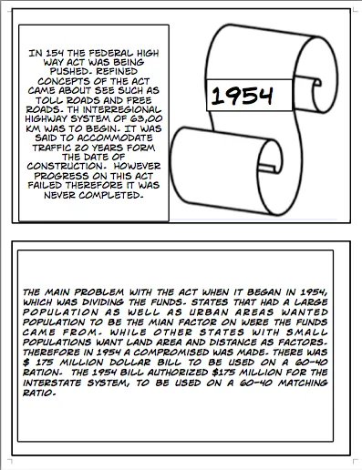 Photo: Federal-Aid Highway Act of 1956, via scienceleadership.org
Even today, emergency responders in southern Illinois carry maps that trace their lineage back to routes first documented in Hartwell's careful handwriting.
The Extraordinary in the Everyday
Chester Hartwell retired in 1956, having walked an estimated 180,000 miles over the course of his career—equivalent to circling the Earth more than seven times. He never sought recognition for his geographic contributions, viewing them simply as part of doing his job well.
"People think mapping is about satellites and computers," said Dr. Sarah Chen, a geographic information systems specialist who studied Hartwell's work for her doctoral dissertation. "But the most accurate maps have always been built by people who know the land intimately. Chester understood that you can't capture a place from a distance—you have to walk it, season after season, year after year."
Hartwell's story reminds us that transformative contributions often emerge from the intersection of opportunity and character. He could have simply delivered the mail and gone home. Instead, he chose to pay attention, to document, to care about the details that others overlooked.
In an age of GPS and satellite imagery, it's easy to forget that our most sophisticated navigation systems rest on a foundation built by people like Chester Hartwell—ordinary workers who understood that extraordinary service means seeing possibilities where others see only routine. His legacy lives on in every highway sign, every emergency response, every successful journey through the American landscape he so carefully mapped, one footstep at a time.